|
|
Cape Ann Interlude
By Tamsin Venn. Photos by Tamsin Venn and David Eden.
Many paddlers zoom around Cape Ann, Mass., every July in a frenzy as they compete in the famed Blackburn Challenge, a 22-mile open ocean race. They don’t know what they are missing. Cape Ann’s coves and rocky shoreline are worth lingering around for an afternoon or morning. You can even make it a full day of fantastic paddling.
Cape Ann thrusts its gnarly, rock-bound head into the Atlantic with Gloucester as its anchor, and a canal bisects the cape at the western end making a circumnavigation possible, hence the handy logistics of the Blackburn Challenge course.
Cape Ann has many good put-in points, but one of our favorites is Lane’s Cove in Lanesville on the west side of Cape Ann, not far from the mouth of the Annisquam River. Whenever we get a hankering for a Maine-style paddling experience, we hop in our car and drive the half hour over the Annisquam Bridge, to Lane’s Cove. A granite shoreline and clear water are the rewards.
|
|

|
|
|
Our goal this July day is to paddle north up the shoreline catching the last of the outgoing tide, turn around, and paddle back past the cove with the incoming tide to a nice sandy beach lunch spot, then back again with afternoon winds predicted to gust up to 20, at our backs. Remarkably, the plan works perfectly, as many know is not always the case.
A sleepy village with solid homes built by Scandinavian craftsmen, Lanesville was once a great fishing port – cod so plentiful, you could row out into Ipswich Bay and bring back a boat load. Then Lanesville prospered during the granite quarrying era. (Cape Ann is covered with abandoned quarries, providing perfect freshwater swimming holes for those homeowners lucky enough to live by them.) Lane’s Cove has a massive breakwater created so that townspeople could load cut stone onto the granite sloops. When the granite industry died in the 1930s, it left a lovely, quiet weather-beaten village, with granite stoops, colorful gardens, artists and their studios, and a few small shops, blessedly impervious to McMansionitis and Dunkin’ Donuts. The cove, meanwhile, still retains its working-class status, protecting mostly lobster and fishing craft, with a decided minority of pleasure boats.
|
|
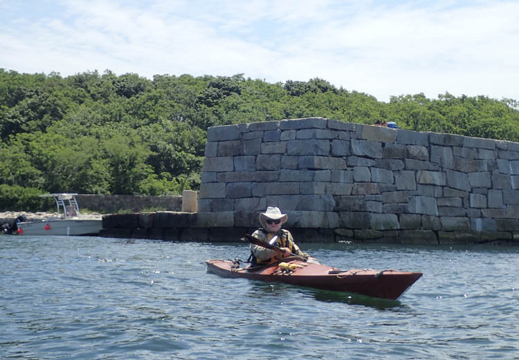
David Eden paddles out past the massive breakwater at the entrance of Lanes Cove.
|
|
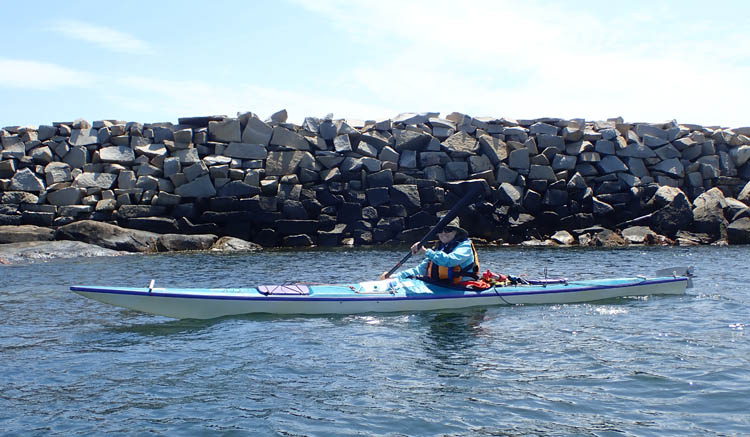
Most of the breakwater is just tumbled granite quarry waste. These piles are very common along Cape Ann's coastline.
|
|
|
We often paddle here off-season when the cove is nearly deserted and were surprised to see the many families and kids frolicking off the dock and rocky beach with every kind of float toy imaginable. The cove , a tiny enclave surrounded by its guardian wall, is a perfect safe swimming spot.
We park next to two cars with surfski racks, their owners long gone. Parking here is rough - unpaved, with spaces for about ten cars by the launch ramp and some road-side spots farther up towards the main road. Still, the marine foundations are solid, with a ramp that doesn't quite make the water at low tide, leaving a slippery surface of boulders and seaweed to walk nimbly across to launch or land your kayak.
We turn right out of the breakwater, heading northeast along the coast towards Folly Cove and Halibut Point. A lobsterman kindly waits for me to exit the narrow entrance to the cove, a sign that kayaks are now finally accepted, 30 years after arriving in these waters, on their way via Great Britain, Seattle, and Maine.
|
|
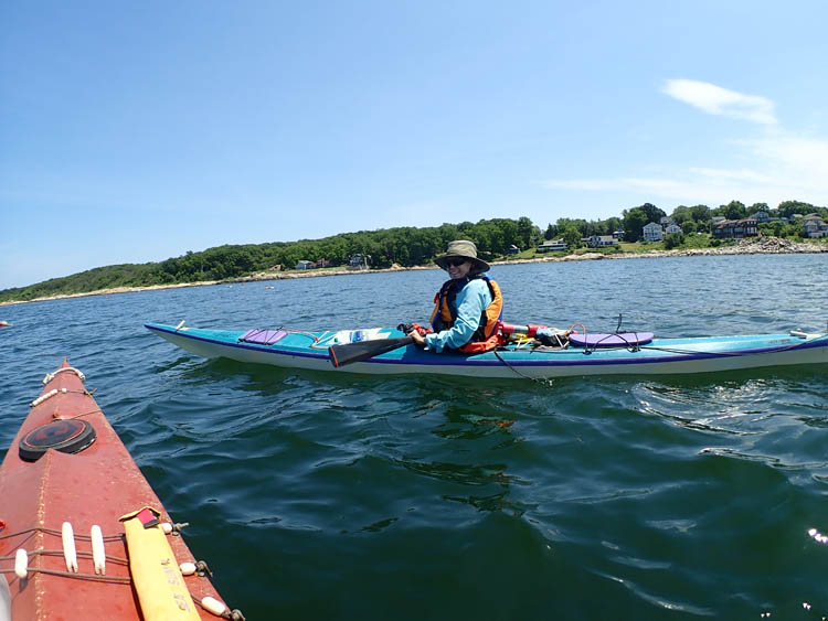
Paddling north towards Folly Cove. The unexpected "wild coast" is ahead in the distance.
|
|
|
The day is clear with a full view across Ipswich Bay to the white huddle of the Isles of Shoals, the New Hampshire coastline, and Mount Agamenticus in Maine. One new view takes getting used to - Hog Island in the Essex Estuary, mostly shorn of trees and balding after the Trustees cleared a large part of the island after an exceptionally severe storm, revealing its contour.
Along the way, rocky outcrops provide perches for cormorants to dry their wings. The water is remarkably clear, and you will probably see the diving flags of scuba divers exploring the rich biomarine underwater landscape. Visibility here is excellent, up to 30 feet, some divers say. Cormorants, Canada geese, and eider families keep us company.
We paddle north, noting for the first time a huge swath of undeveloped land (see what you notice when you are not racing by?). We go into the steep-sided Folly Cove, also known as Gallop's Folly, after John Gallop, a Boston pilot, mistook the mouth of the cove for a larger, safer harbor and lost his vessel on the rocks. The shipwreck took place in 1635, which shows you how long people's memories are around here.
|
|
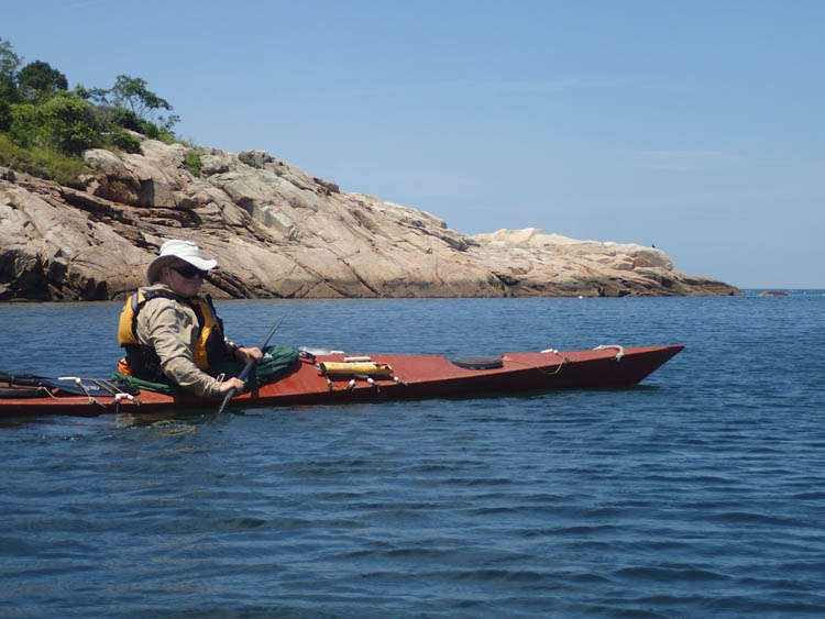
At the entrance to Folly Cove. Rocks like those behind David surround the cove and are what caused poor John Gallop to lose his ship.
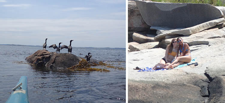
L: Although ospreys, bald eagles, seals, porpoises, and even whales have been spotted near Cape Ann, we saw only cormorants, gulls, and a flock of eiders. R: The rocks all along the coast are used for sunbathing on good days.

Some samples of Folly Cove designs, produced between 1938 and 1968.
|
|
|
Folly Cove is also known for a group of 45 textile designers who worked in Gloucester, Mass., mid-20th-century doing bold block printing on fabric. Their leader was Virginia Lee Burton Demetrios, author and illustrator of the popular children’s book, Mike Mulligan and His Steam Shovel. You can see their work at the nearby Cape Ann Museum in Gloucester.
Back to the water. Just beyond Folly Cove is Halibut Point, a major mark for the Blackburn participants, and site of a former rock quarry, and our turnaround. Halibut Point is remarkable for a huge headland formed entirely of quarry rubble thrusting into the sea. There is also a 60-foot WWII shore battery aiming tower on top. Hard to miss Halibut Point, unless it's foggy.
|
|
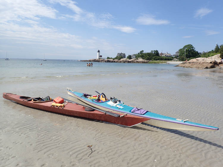
Lunch beach, just south of the lighthouse. There are several tiny pocket beaches off to the right. The water in the cove was so shallow that it was a 30-yard drag to the water by the time we finished eating.
|
|
|
We retrace our route, going south, past Lane’s Cove; Plum Cove, a wonderful local pocket beach; and Hodgkins Cove, once the site of a loading dock for shipping Gloucester granite, and now a site for University of Massachusetts’ program in sustainable fisheries and coastal resilience.
Now we pass the Annisquam Harbor Light Station. Here is more history: In 1801, government officials started the lighthouse at Wigwam Point, a common meeting ground for the local First People, to serve as a marker for the entrance to the Annisquam River. In 1897, they replaced a second lighthouse with the white brick tower you see now. They added a fog horn in 1931, but soon decided to operate it only from October to May so summer residents could sleep at night, and boo to the poor fisher- or lobsterman out in an early morning pea soup. The Coast Guard completely renovated the lighthouse in 2000, replacing several thousands of old bricks, and it is now automated.
For more adventure, you can paddle south, paddle past the hopping Annisquam Yacht Club, and into tranquil Lobster Cove or a short paddle across the Annisquam River to Wingaersheek Beach to loll around there.
There are several pocket beaches just south of the lighthouse you can land on in high season, without disturbing summer renters on the larger beach. As there were few of these when we pulled into the cove, we opted to land on the very gently sloping sandy beach, right in the center of the cove. Our goal: lunch! And a bit of a dip, snooze, and read on this very fine afternoon. After a bracing swim and tuna sandwiches for lunch, we make the approximately two-mile journey back to Lane’s Cove, where kids are still leaping onto each other in the water and families are lighting up their barbecues. Ah, summer.
We land at extreme low tide, which means the take-out is a bit dicey, negotiating the slippery, weed-coated boulders just below where the paved ramp ends. Still, not a bad take-out. We notice a couple of painters working in oils on top of the breakwater and stop to admire their efforts. The “maestro” owns a gallery in Rockport, and you or I could go down to that gallery and buy a piece of the amazing scenery we have just paddled through.
We quit late afternoon, but had you stayed you would have been rewarded with a glorious sunset over Ipswich Bay.
Distance: Seven Miles. Tide: High at Noon, 9.2 feet. Winds: South 5-10, gusting to 20 in the afternoon. Weather: Sunny and clear. Experience: Priceless.
|
|
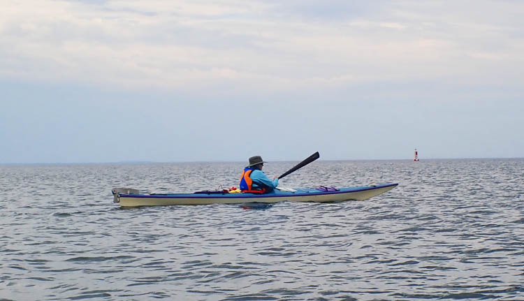
Returning north from the lunch beach to Lanes Cove.
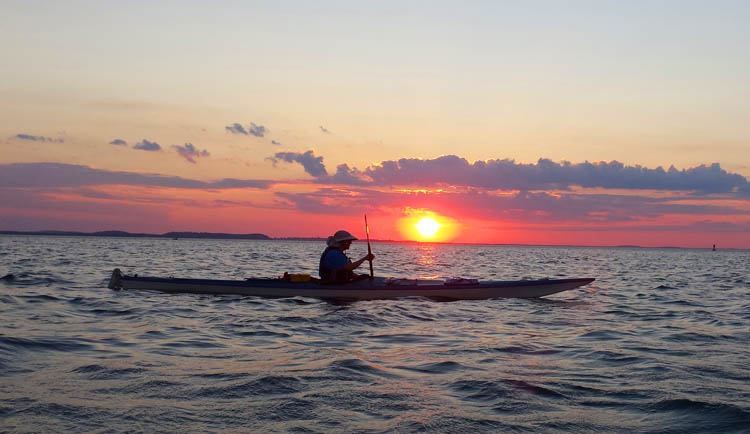
The trip north along the Cape Ann coast is a perfect sunset paddle if you catch the right weather, as the sun drops to your left. This picture was taken two years ago in almost the same spot as the previous one, as you can tell by the gong bouy.
|
|
|
Directions to Lanes Cove:
Head towards Gloucester on Rt 128N. Shortly after crossing the bridge over the Annisquam River, take the third right in the traffic circle onto Rt 127/Washington Street. At around five miles, turn left onto Andrews Street/Lanes Cove Road where 127 takes a sharp curve to the right. Follow to the end at the parking lot.
|
| | | | | | |
